
datnyvei:LocationAtlanticOcean.png

Size of this preview: 800 × 405 pixels. Other resolutions: 320 × 162 pixels | 640 × 324 pixels | 1,024 × 519 pixels | 1,280 × 648 pixels | 2,760 × 1,398 pixels.
Original file (2,760 × 1,398 pixels, file size: 281 KB, MIME type: image/png)
i ve skicu
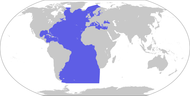
| Description | World map depicting Atlantic Ocean; map adapted from PDF World map at CIA World Fact Book |
| Date | |
| Sabji | 800px-LocationBlank.png |
| Author | user:Xfigpower |
Licensing
This image is in the public domain because it contains materials that originally came from the United States Central Intelligence Agency's World Factbook.
|
 |
lo vreji citri
Click on a date/time to view the file as it appeared at that time.
| detytcika | Thumbnail | Dimensions | pilno | pinka | |
|---|---|---|---|---|---|
| cabna | 18:47, 29 ly. pa 2024 | | 2,760 × 1,398 (281 KB) | Janitoalevic | . |
| 08:10, 28 ly. ci 2019 |  | 2,760 × 1,398 (223 KB) | Lasunncty | Higher resolution and more accurate boundaries | |
| 22:34, 3 ly. xa 2018 |  | 800 × 407 (52 KB) | Janitoalevic | . | |
| 13:56, 30 ly. pa pa 2006 |  | 800 × 407 (73 KB) | Xfigpower | {{Information |Description=World map depicting Atlantic Ocean; map adapted from PDF World map at CIA World Fact Book |Source=800px-LocationBlank.png |Date=2006-11-30 |Author=user:Xfigpower |Permis |
vreji nu pilno
The following page uses this file:
Global file usage
The following other wikis use this file:
- Usage on an.wikipedia.org
- Usage on ar.wikipedia.org
- المغرب العربي
- رأس الرجاء الصالح
- آيسلندا
- إسبانيا
- المحيط الهندي
- برمودا
- المحيط الهادئ
- ساو تومي وبرينسيب
- تاريخ ليبيا القديم
- قنطبرية
- قناة بنما
- الدار البيضاء
- أشتورية
- منطقة إقليم الباسك
- جليقية (منطقة)
- تصنيف:آيسلندا
- جزر الكناري
- جرينلاند
- مونتسرات
- مارتينيك
- المحيط المتجمد الشمالي
- المحيط الجنوبي
- خليج المكسيك
- البحر الكاريبي
- ميناء الدار البيضاء
- غوادلوب
- جزر العذراء البريطانية
- جزيرة مان
- تيتانيك (فيلم 1997)
- البحر الأيرلندي
- تصنيف:تاريخ ليبيا القديم
- قناة برستل
- جزر فوكلاند
- جزيرة أيرلندا
- سان سيباستيان
- سان بيير وميكلون
- محيط (جغرافيا)
- خليج غينيا
- تصنيف:الجزر العذراء الأمريكية
- من الأرض إلى القمر
- جزر البهاما
- سكاغيراك
- المغرب الكبير (مصطلح)
- الأزور
- سان بارتيلمي
- تجمع سان مارتين
- ميناء سانتوس
- جسر ويليامزبرغ
- نفق جبل طارق
View more global usage of this file.