
datnyvei:North America (orthographic projection).svg

Size of this PNG preview of this SVG file: 550 × 550 pixels. Other resolutions: 240 × 240 pixels | 480 × 480 pixels | 768 × 768 pixels | 1,024 × 1,024 pixels | 2,048 × 2,048 pixels.
Original file (SVG file, nominally 550 × 550 pixels, file size: 457 KB)
i ve skicu
| Description |
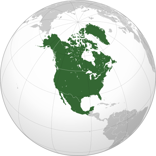
বাংলা: ওত্তরী আমেরিকার অর্থোগ্রাফিক মানচিত্র हिन्दी: उत्तरी अमेरिका का लेखनप्रक्षेपीय मानचित्र English: North America (orthographic projection) |
||||
| Date | |||||
| Sabji |
ponse gunka (Original text: Own work,)
|
||||
| Author | Heraldry | ||||
| Permission (Reusing this file) |
|
||||
| Other versions |
Derivative works of this file: BK North America (orthographic projection).png .svg) |
||||
| SVG genesis | SVG watermarked with invisible embedded text. |

.svg)
.svg)
.svg)
.svg)
.svg)
.svg)
.svg)
.svg)
.svg)
.svg)
.svg)
.svg)
.svg)
.svg)
.svg)
.svg)
.svg)
.svg)
.svg)
.svg)
.svg)
.svg)
.svg)
.svg)
.svg)
.svg)
.svg)
.svg)
.svg)
.svg)
.svg)
.svg)
.svg)
.svg)
.svg)
.svg)
.svg)
.svg)
.svg)
.svg)
.svg)
.svg)
.svg)
.svg)
.svg)
.svg)
.svg)
.svg)
.svg)
.svg)
.svg)
.svg)
.svg)
.svg)
.svg)
.svg)
.svg)
.svg)
.svg)
.svg)
.svg)
.svg)
.svg)
.svg)
.svg)
.svg)
.svg)
.svg)
.svg)
.svg)
.svg)
.svg)
.svg)

.svg)

.svg)

.svg)
.svg)
.svg)
.svg)
.svg)
.svg)
.svg)


.svg)
.svg)
.svg)
.svg)
.svg)
.svg)
.svg)

.svg)
.svg)
.svg)
.svg)
.svg)
.svg)
.svg)
.svg)
.svg)

.svg)
.svg)
.svg)
.svg)
.svg)
.svg)
.svg)
_without_national_boundaries.svg)
.svg)
.svg)
.svg)
.svg)
.svg)
.svg)

.svg)
.svg)
.png)
.svg)
.svg)
.svg)
.svg)

.svg)
.svg)
.svg)
.svg)
.svg)
.svg)
.svg)
.svg)
.svg)
.svg)
.svg)

.svg)
.svg)
.svg)
.svg)
.svg)
.svg)
.svg)
.svg)
.svg)

.svg)
.svg)

.svg)
.svg)
.svg)
.svg)
.svg)
.svg)
.svg)
.svg)
.svg)
.svg)
.svg)
.svg)
.svg)
.svg)
.svg)
.svg)
.svg)
.svg)
.svg)
.svg)
.svg)
.svg)
.svg)
.svg)
.svg)
.svg)
.svg)
_-_Crimea_disputed.svg)
.svg)
.svg)
.svg)
.svg)
.svg)
.svg)
.svg)
.svg)
.svg)
.svg)
.svg)
_political.svg)
.svg)
.svg)
.svg)
.svg)
_-_Crimea_disputed_-_no_borders.svg)
.svg)
.svg)
.svg)
.svg)
.svg)
.svg)
.svg)
.svg)
.svg)
.svg)
.svg)

.svg)
.svg)
.svg)

.png)
.svg)
.svg)
.svg)
.svg)
.svg)
.svg)
.svg)
.svg)
.svg)
.svg)
.svg)
.svg)
.svg)
.svg)
.svg)
.svg)
.svg)
.svg)
.svg)
.svg)
.svg)
.svg)
.svg)
.svg)
.svg)
.svg)
.svg)
.svg)
.svg)
.svg)
.svg)
.svg)
.svg)
.svg)
.png)
.svg)
.svg)
.svg)
_(orthographic_projection).png)
.svg)
.png)
.svg)
.svg)
.svg)
.svg)
Licensing
I, the copyright holder of this work, hereby publish it under the following license:

|
Permission is granted to copy, distribute and/or modify this document under the terms of the GNU Free Documentation License, Version 1.2 or any later version published by the Free Software Foundation; with no Invariant Sections, no Front-Cover Texts, and no Back-Cover Texts. A copy of the license is included in the section entitled GNU Free Documentation License. |
| This file is licensed under the Creative Commons Attribution-Share Alike 3.0 Unported license. | ||
| ||
| This licensing tag was added to this file as part of the GFDL licensing update. |
lo vreji citri
Click on a date/time to view the file as it appeared at that time.
| detytcika | Thumbnail | Dimensions | pilno | pinka | |
|---|---|---|---|---|---|
| cabna | 08:38, 27 ly. xa 2023 | | 550 × 550 (457 KB) | Lasunncty | Reverted to version as of 16:06, 17 January 2023 (UTC) duplicate |
| 19:49, 25 ly. xa 2023 |  | 550 × 550 (455 KB) | HelpfulHens | Central America and the Caribbean are all part of North America | |
| 16:06, 17 ly. pa 2023 |  | 550 × 550 (457 KB) | Bultro | the map with all Mexico and Caribbean is file:Location North America.svg. We just also want THIS map. You may ask to rename it | |
| 22:28, 8 ly. pa 2023 |  | 550 × 550 (414 KB) | HelpfulHens | Added Central America and the Caribbean | |
| 22:16, 8 ly. pa 2023 |  | 550 × 550 (457 KB) | Bultro | the map without Mexico is File:Northern America (orthographic projection).svg | |
| 17:33, 7 ly. pa 2023 |  | 550 × 550 (676 KB) | HelpfulHens | Removed Mexico | |
| 16:42, 7 ly. so 2009 |  | 550 × 550 (457 KB) | TownDown | sized according | |
| 08:52, 10 ly. ze 2009 |  | 541 × 541 (457 KB) | PuebloUnited | details | |
| 08:23, 25 ly. xa 2009 |  | 541 × 541 (458 KB) | TownDown | {{Information |Description={{en|1=North America}} |Source=trabajo propio (own work) |Author=TownDown |Date= |Permission= |other_versions= }} <!--{{ImageUpload|full}}--> Category:Orthographic projections |
vreji nu pilno
The following page uses this file:
Global file usage
The following other wikis use this file:
- Usage on af.wikipedia.org
- Noord-Amerika
- Verenigde State van Amerika
- Kaaimanseilande
- Kanada
- Ottawa
- Groenland
- Sint Pierre en Miquelon
- Hoofstad
- Lys van hoofstede
- Meksiko
- Aruba
- Oranjestad
- Kategorie:Lande in Noord-Amerika
- Sint Maarten
- Kuba
- Washington, D.C.
- Lys van lande
- Puerto Rico
- Havana
- Costa Rica
- Honduras
- Belize
- Guatemala
- El Salvador
- Nicaragua
- Panama
- Jamaika
- St. Lucia
- San José, Costa Rica
- Tegucigalpa
- San Salvador
- Castries
- Barbados
- Lys van nasionale leuses
- Sjabloon:Lande van Noord-Amerika
- Sjabloon:Lande van Amerika
- Clipperton
- Dominikaanse Republiek
- Meksikostad
- Amerikas
- Sjabloon:Hoofstede in Noord-Amerika
- Bahamas
- Haïti
- Antigua en Barbuda
- Trinidad en Tobago
- Dominica
- Grenada
- St. Kitts en Nevis
- St. Vincent en die Grenadine
- Belmopan
View more global usage of this file.
.svg)
.svg)